Skip navigation

RAMMB: Regional and Mesoscale Meteorology Branch logo CIRA: Cooperative Institute for Research in the Atmosphere logo NESDIS: NOAA Environmental Satellite, Data, and Information Service logo

RAMSDIS Online Archive

tropical/tropical_cira_blended_tpw1_25km

Below are the available images for this product, sorted in reverse chronological order (newest images are first). By default, the first 12 images are selected for a loop - simply click any of the "Loop" buttons. To select a specific range of images click an option for "Starting Image" and "Ending Image", and then click any of the "Loop" buttons.

Clicking on an "Image" link will display the image for that specific time.

You can now view the archive with thumbnails of each image to get a preview of the full-size images. Please note that the page will take longer to load due to the many images in the archive.
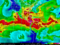

tropical/tropical_cira_blended_tpw1_25km thumbnail
Time (UTC) Starting Image Ending Image Display Loop Display Image
2024-07-04 08:00 Image
2024-07-04 02:00 Image
2024-07-03 20:00 Image
2024-07-03 14:00 Image
2024-07-03 08:00 Image
2024-07-03 02:00 Image
2024-07-02 20:00 Image
2024-07-02 14:00 Image
2024-07-02 08:00 Image
2024-07-02 02:00 Image
2024-07-01 20:00 Image
2024-07-01 14:00 Image
2024-07-01 08:00 Image
2024-07-01 02:00 Image
2024-06-30 20:00 Image
2024-06-30 14:00 Image
2024-06-30 08:00 Image
OSZAR »